February 29th, 2024
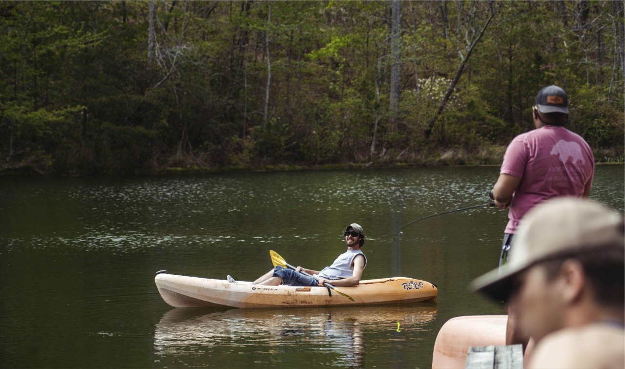
Welcome to Southeast Lineman Training Center, we’re glad you’re here! Our southeast region offers incredible opportunities for adventure during your time here. Whether you’re looking for a quick day trip or a weekend long adventure, here’s our pick of the best options around!
Distance from SLTC: 1 Hour 17 Minutes
Photo Credit: https://www.hotels.com/de1481266/hotels-guntersville-alabama/
Lake Guntersville State Park rests along the banks of the Tennessee River in Northeast Alabama. Among the recreational offerings are an 18-home championship golf course, the Screaming Eagle Zipline, a beach complex, an outdoor nature center, excellent fishing in Alabama’s largest lake, 36 miles of hiking and biking trails, weekly guided hikes, and a day-use area. (https://www.alapark.com/parks/lake-guntersville-state-park)
Distance from SLTC: 1 Hour
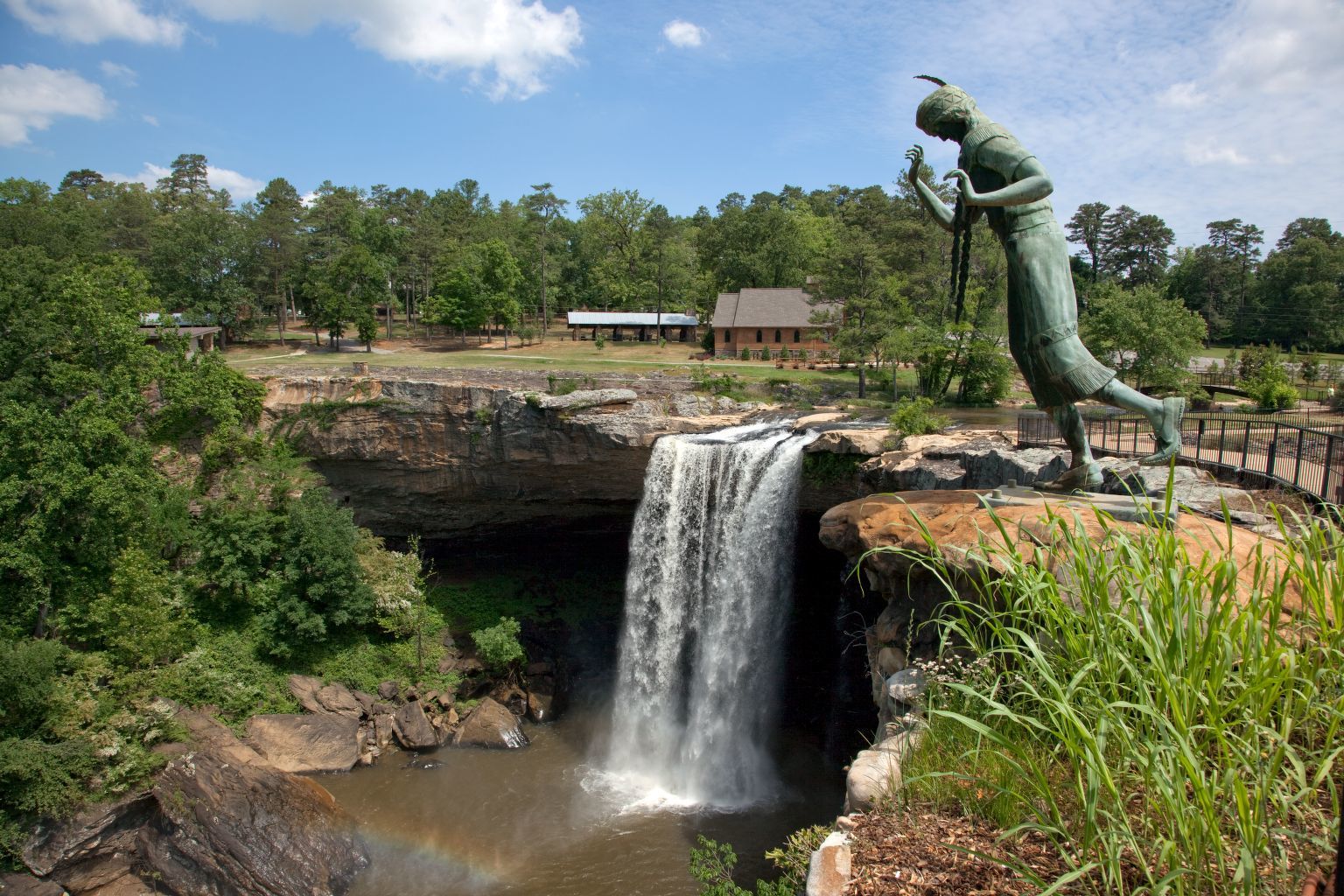
Photo Credit: https://www.loc.gov/item/2010640434/
Encompassing 500 acres of land situated in the foothills of the Appalachian Mountains, Noccalula Falls Park and Campground is a must-see destination in Northeast Alabama. Hike one of Black Creek Trails 15 trails and connectors for those who enjoy walking, running, hiking and bicycling or check out the Gorge Trail and pass under the famous Falls! Visitors can also enjoy mini golfing, fly fishing and camping. (https://www.noccalulafallspark.com/park-information/)
Distance from SLTC: 33 Minutes
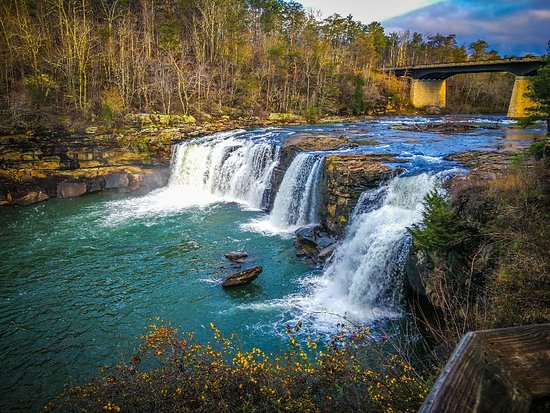
Photo Credit: https://www.rollbamaroll.com/2019/5/31/18646685/85-things-to-love-about-alabama-little-river-canyon-desoto-falls
Little River is unique because it flows for most of its length atop Lookout Mountain in northeast Alabama. The preserve offers a diverse range of recreational opportunities, including swimming, fishing, climbing, hiking, and world-class whitewater paddling. Canyon Rim Drive hugs the west rim of Little River Canyon, offering scenic drives and connecting a series of overlooks that offer views into the canyon. (https://www.nps.gov/liri/index.htm)
Distance from SLTC: 33 Minutes
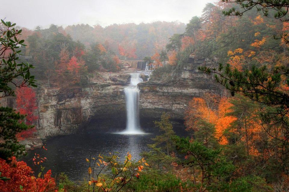
Photo Credit: https://www.loc.gov/item/2010640434/
Encompassing 500 acres of land situated in the foothills of the Appalachian Mountains, Noccalula Falls Park and Campground is a must-see destination in Northeast Alabama. Hike one of Black Creek Trails 15 trails and connectors for those who enjoy walking, running, hiking and bicycling or check out the Gorge Trail and pass under the famous Falls! Visitors can also enjoy mini golfing, fly fishing and camping. (https://www.noccalulafallspark.com/park-information/)
Distance from SLTC: 12 Minutes
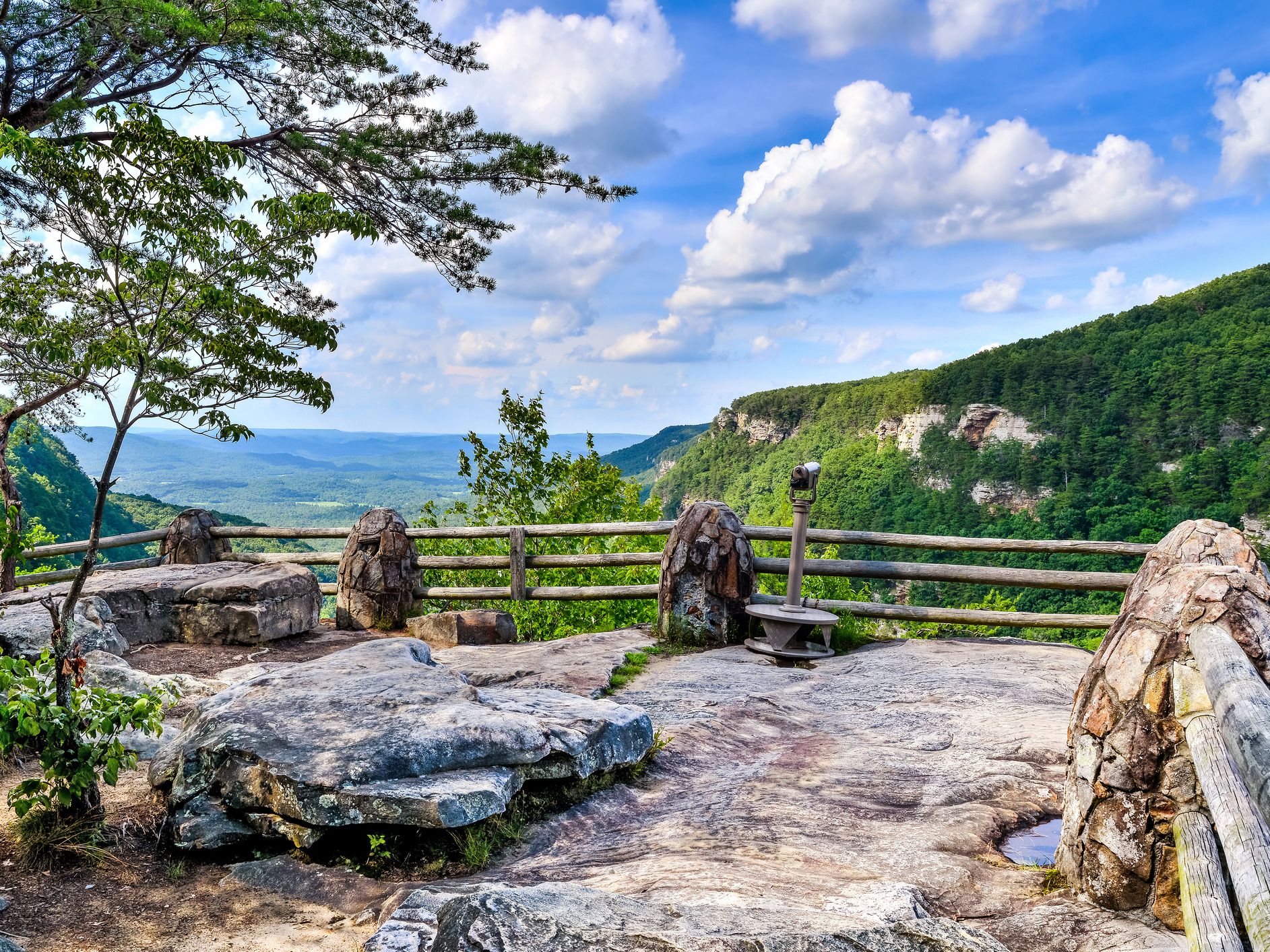
Photo Credit: https://www.tripsavvy.com/cloudland-state-park-the-complete-guide-5076956https:
Located on the western edge of Lookout Mountain, Cloudland Canyon is one of the largest and most scenic parks in the state. Home to thousand-foot deep canyons, sandstone cliffs, wild caves, waterfalls, cascading creeks, dense woodland and abundant wildlife, the park offers ample outdoor recreation. Hiking and mountain biking trails abound. The park also offers disc golf, a fishing pond, trails for horseback riding, picnicking, and overlooks. Consider hiking from Sitton’s Gulch Trail that beings just 7 minutes from the school, and hikes up the side of Lookout Mountain at Cloudland Canyon. (https://gastateparks.org/CloudlandCanyon)
Distance from SLTC: 20 Minutes
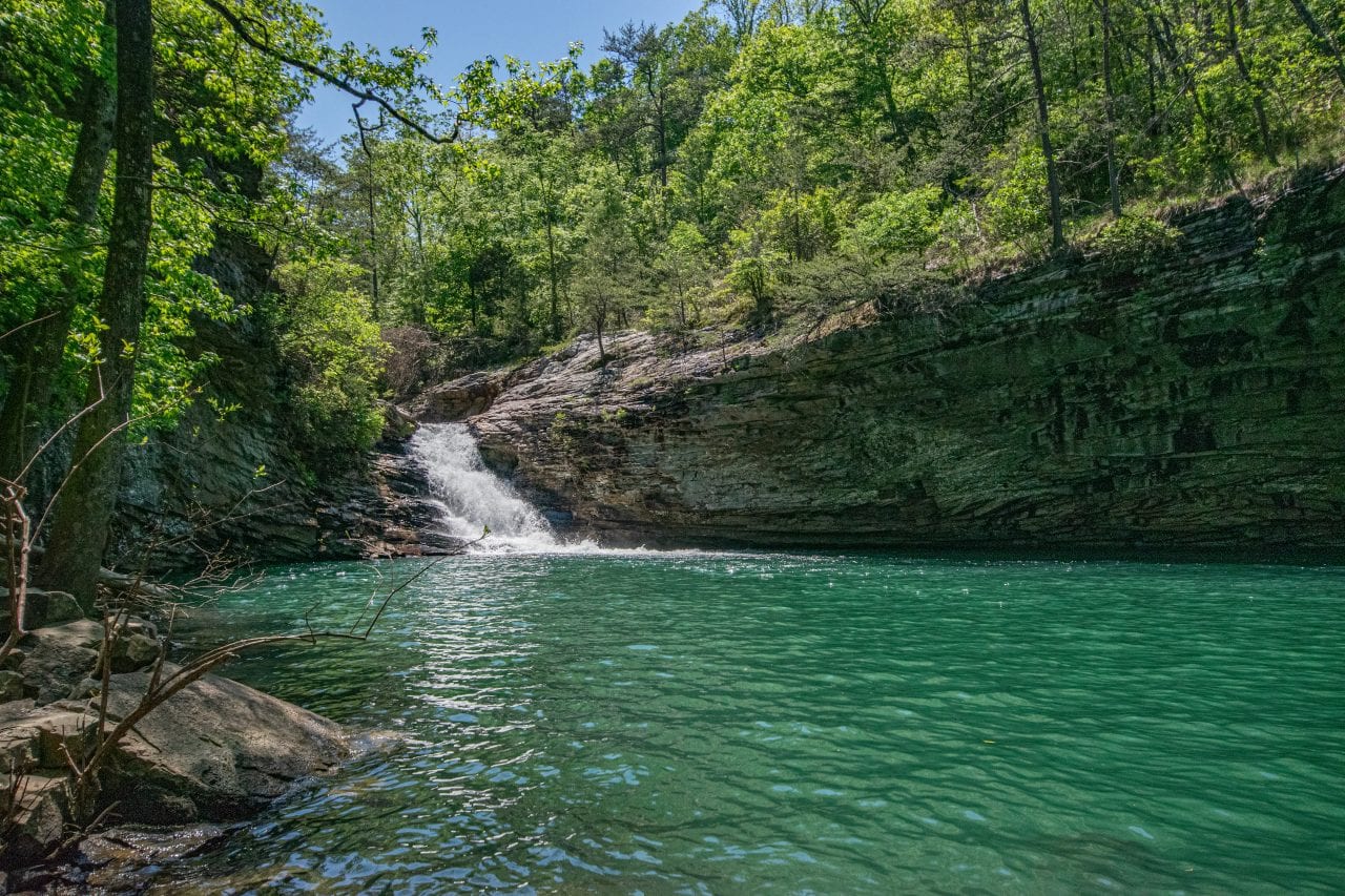
Photo Credit: https://www.colemanconcierge.com/lula-lake-trails-10-things-you-need-to-know-before-you-go/
Lula Lake Land Trust was established in 1994 by the will of Mr. Robert Davenport Sr. Since then, they have helped to conserve over 8,000 acres on Lookout Mountain, doubling the size of Cloudland Canyon State Park. Lula Lake is only open to the general public on the first and last weekends of each month during their Public Access Dates, or more commonly referred to as Open Gate Days. A reservation must be made online at (https://www.lulalake.org/visit.html).
Distance from SLTC: 26 Minutes
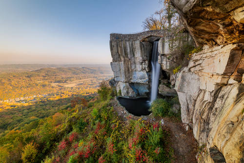
Photo Credit: http://www.aaa.com/travelinfo/georgia/lookout-mountain/attractions/rock-city-gardens-513668.html
Located atop Lookout Mountain in Georgia just six miles from downtown Chattanooga, Rock City Gardens is an enchanted 4,100-foot walking trail showcasing soaring rock formations, caves, and lush gardens. (https://www.seerockcity.com/)
Distance from SLTC: 44 Minutes
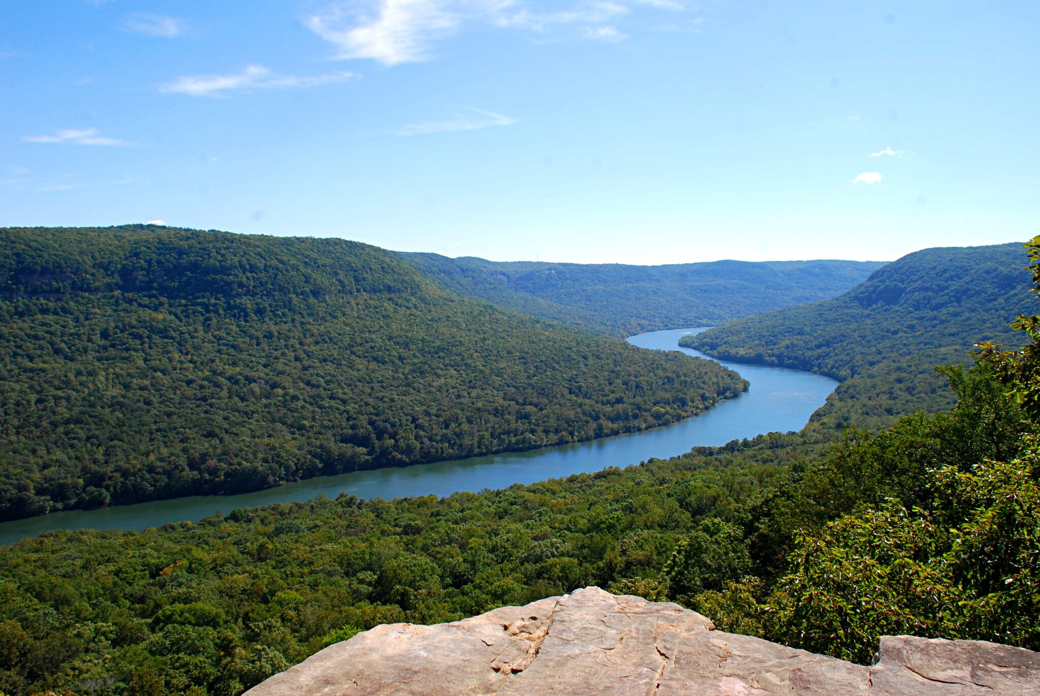
Photo Credit: https://www.southeasttennessee.com/a-three-overlook-hike-in-prentice-cooper-state-forest/
Prentice Cooper State Park is located in southeastern Tennessee, in Marion County situated on the scenic Tennessee River Gorge. There are 35 miles of hiking trails, including the south end of the Cumberland Trail State Park. Open to OHV/ATV/Off-Road vehicles, hunting, hiking, camping, fishing, and has a shooting range on-site. (The beautiful mountain view is located at Snoopers Rock in Prentice Cooper State Park. (https://www.tn.gov/agriculture/forests/state-forests/prentice-cooper.html)
Distance from SLTC: 2 Hour 11 Minutes
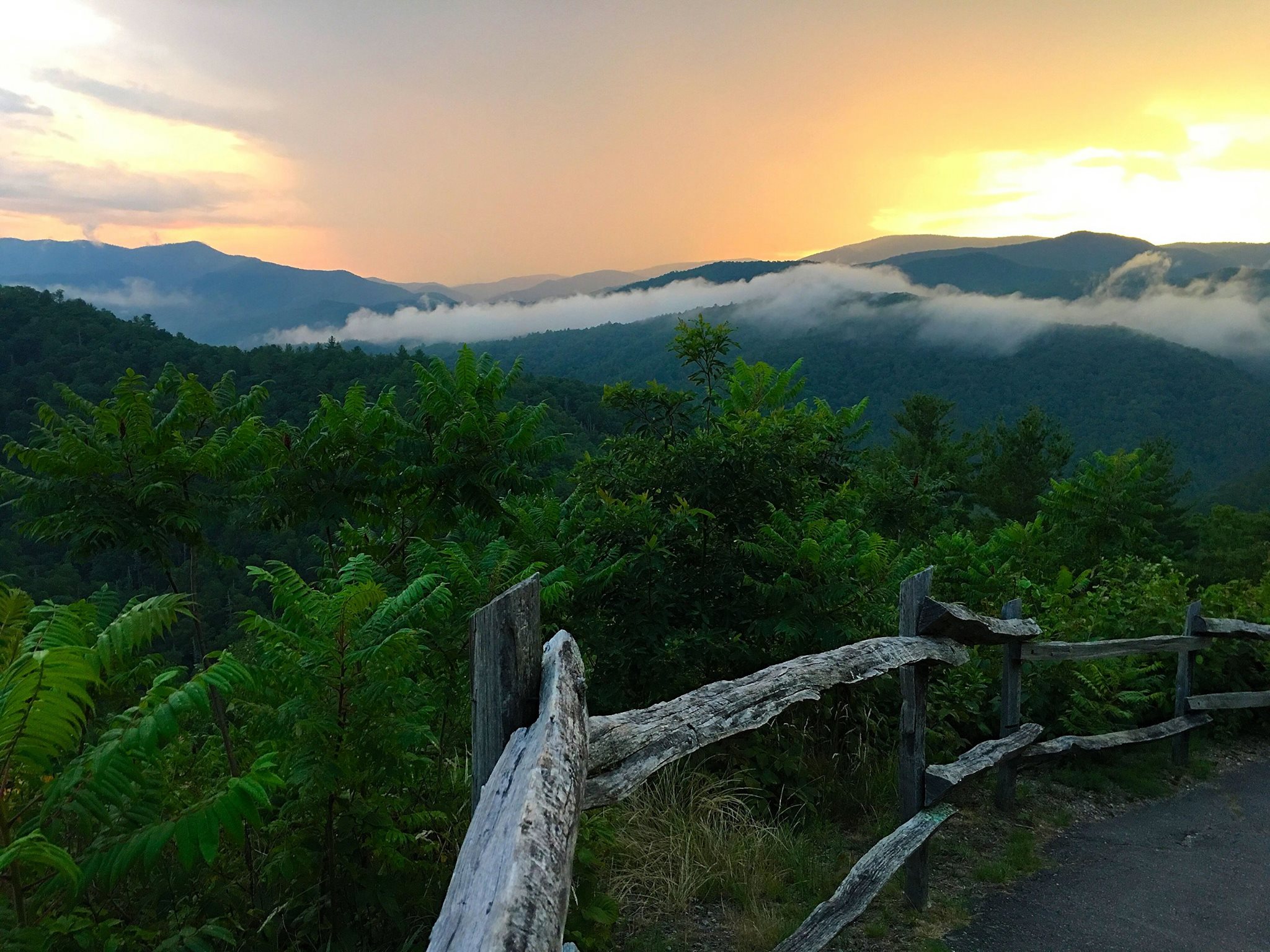
Photo Credit: https://friendsofthesmokies.org/blog/5-things-gsmnp-shut-down/
Ridge upon ride of forest straddles the border between North Carolina and Tennessee in Great Smoky Mountains National Park. World renowned for its diversity of plant and animal life, the beauty of its ancient mountains, and the quality of its remnants of Southern Appalachian mountain culture, this is America’s most visited national park. Some of the most popular destination hikes in the park include: Charlies Bunion, Alum Cave Bluffs, Andrews Bald, Rainbow Falls, and Chimney Top. (https://www.nps.gov/grsm/index.htm)
Distance from SLTC: 39 Minutes
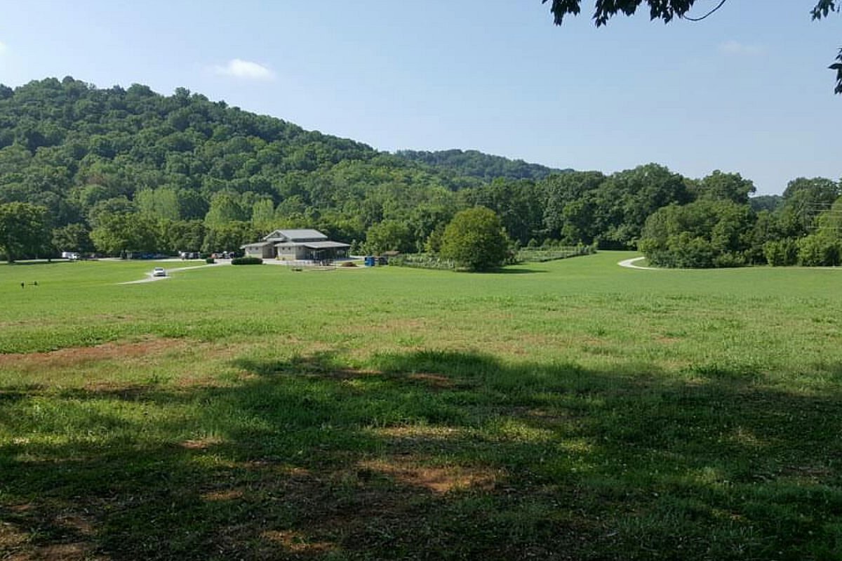
Photo Credit: https://www.tripadvisor.com/Attraction_Review-g55105-d9885023-Reviews-Greenway_Farms_Conference_Center-Hixson_Tennessee.html
Greenway Farms offers a variety of opportunities to enjoy the flatwater section of North Chickamauga Creek. A walking trail follows the creek around a horseshoe bend, a dog park offers exercise options for our furry friends, and the calm water and close proximity of put-ins and takeouts make this a favorite spot for paddlers who don’t want a longer shuttle. (https://www.northchick.org/adventure/greenway-farms/)
Distance from SLTC: 21 Minutes
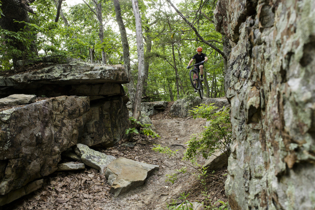
Photo Credit: https://rootsrated.com/chattanooga-tn/mountain-biking/raccoon-mountain-mountain-biking
Raccoon Mountain Caverns consists of over 5.5 miles of underground passageways. While many caves have small areas of formation growth, Raccoon Mountain Caverns has countless, 100% natural formations and is exceptionally well preserved, considered to be one of the most geologically active caverns in the South. Raccoon Mountain also features nearly 30 miles of multi-use trail available for mountain biking, hiking and trail running. (https://www.raccoonmountain.com/)
Distance from SLTC: 42 Minutes
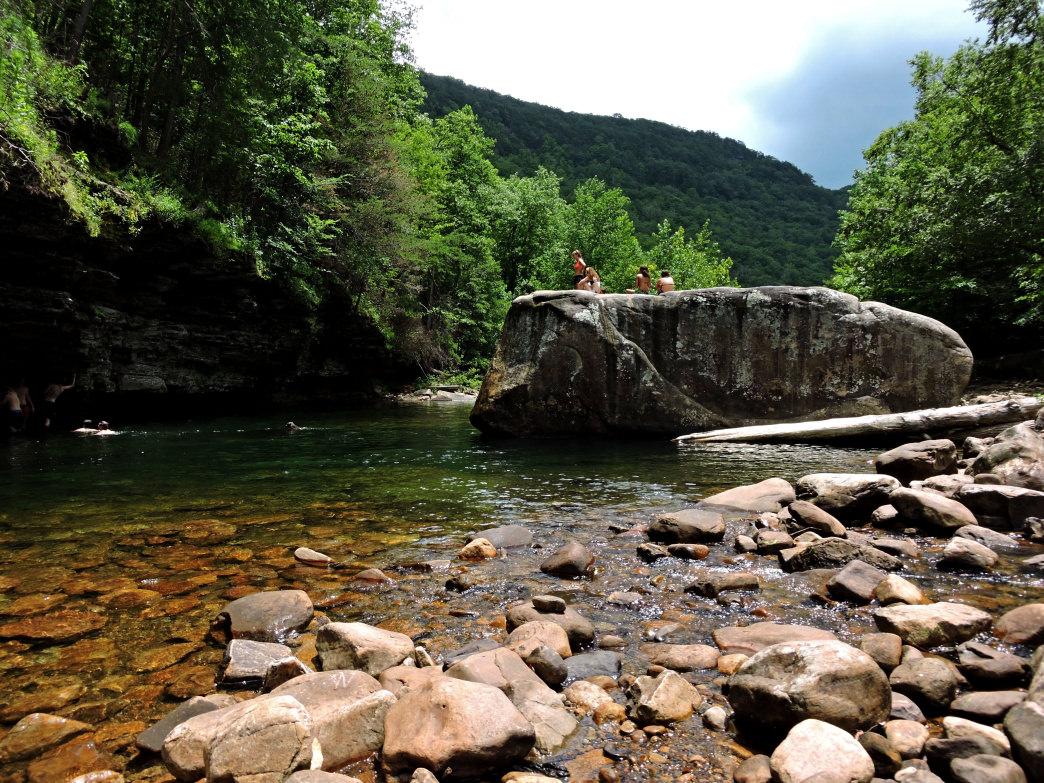
Photo Credit: https://rootsrated.com/chattanooga-tn/hiking/north-chick-blue-hole
The Blue Hole, as it is locally known, is just 20 minutes from downtown in the North Chickamauga Creek Gorge. This is some of the most beautiful country in the southeast, with a huge watershed and several creeks cutting deep gorges into Walden’s Ridge and the Cumberland Plateau. The hike to the blue hole is short, but you’ll want to spend some time exploring! (Local Tip: Follow the trail that crosses the creek to reach the Blue Hole. (https://rootsrated.com/chattanooga-tn/hiking/north-chick-blue-hole)